Darfur Genocide Mapped with Google Earth
Here’s a fascinating project using modern mapping tools:
The United States Holocaust Memorial Museum has joined with Google in an unprecedented online mapping initiative. Crisis in Darfur enables more than 200 million Google Earth users worldwide to visualize and better understand the genocide currently unfolding in Darfur, Sudan. The Museum has assembled content—photographs, data, and eyewitness testimony—from a number of sources that are brought together for the first time in Google Earth.
Christine Chen explains that the initiative “indicates areas that have been ravaged, refugee camps, destroyed villages, and much more. Users can also gather data and other information from the map. Crisis in Darfur is the first project of a long-term collaboration between Google and the museum to map out areas of genocide. Next in the works is a mapping project of the Holocaust.”
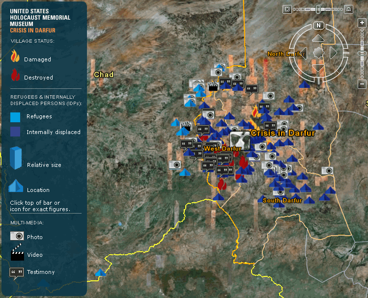 I’ve thumbnailed a screen capture at right (click for a 749×607 image) but it obviously lacks the interactivity of the original. I haven’t played around with Google Earth much but it’s an amazingly powerful application, even compared to the online Google Maps.