Photo Of The Day: The Aftermath Of the Waldo Canyon Fire
Via NASA:
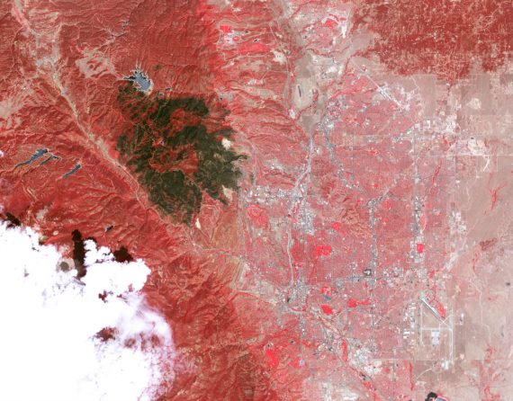
The Advanced Spaceborne Thermal Emission and Reflection Radiometer (ASTER) on the Terra satellite acquired this view of the burn scar on July 4, 2012, when the fire was still burning but was 90 percent contained. Vegetation-covered land is red in the false-color image, which includes both visible and infrared light. Patches of unburned forest are bright red, in contrast with areas where flecks of light brown indicate some burning. The darkest brown areas are the most severely burned. Buildings, roads, and other developed areas appear light gray and white. The bright red patches of vegetation near Colorado Springs are golf courses, parks, or other irrigated land.
As Vodkapundit puts it, Whoa


Where’s Waldo?
Oh, I see, it’s that smoldering brown spot.
(What? You were thinking it! You were all thinking it!)
The fire got with in a few miles of my Aunt and Uncle’s home, but is okay now.