Ohio Voters Approve Redistricting Reform
Ohio voters have approved a referendum designed to reform the manner in which district lines are drawn.
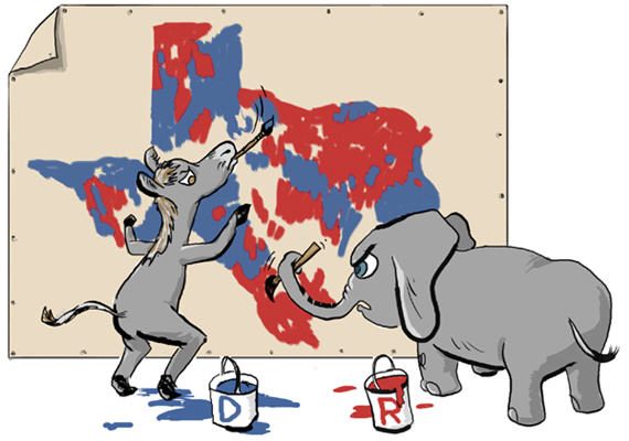
While the Supreme Court wrestles with two cases dealing with political gerrymandering and one dealing with racial gerrymandering, voters in Ohio on Tuesday approved a referendum that would reform the manner in which district lines are drawn in the Buckeye State:
Ohio voters approved a gerrymandering reform proposal Tuesday that would change how the state draws congressional district lines following the next US Census
The Issue 1 ballot measure passed 75% to 25%, based on unofficial results from the Ohio secretary of state’s office. It will be implemented in 2021.
Ohio’s population size in 2020 US Census results will determine the number of seats the state will have in the US House of Representatives. Once the number of seats is determined, the lines will be determined by the state legislature. Then, in order to adopt the map for 10 years, 60% of Ohio state legislators and 50% of members of the two leading parties (likely Republicans and Democrats) must approve it. If it’s not approved, a commission that includes the governor, auditor, Ohio’s secretary of state and four lawmakers will move to approve or decline the redistricting proposal.
If that commission fails to approve the new map, it would be sent back to the statehouse with a lower threshold for approval.
According to the Cincinnati Enquirer, this hybrid of state officials and a commission to determine redistricting would be a national first.
Republicans controlled the 2011 redistricting process and drew a map that favored their party across the state. Democrats currently control only four of the state’s 16 congressional districts.
(…)
Former US Attorney General Eric Holder, now the chair of the National Democratic Redistricting Committee, praised the passage of the reform in Ohio.
“The redistricting reform passed today in Ohio makes it much harder for politicians to rig elections through gerrymandering and gives me hope that we can restore fairness to our elections in states around the country,” Holder said in a statement. “Ohio has proven that when citizens work together to demand their elected officials support a fair redistricting process, positive change is possible.”
The redistricting process that Ohio will be adopting is somewhat different from the reforms that have been implemented in states such as Arizona, California, and 11 other states. Under those systems, redistricting is generally handled via a nonpartisan state commission rather than the state legislature and the final map is submitted to the legislature for an up and down vote, with the proviso that the legislature does not have the authority to amend the map the commission has drawn. Ohio’s procedure would not involve an independent commission per se but would require the Congressional map to be approved by what amounts to a supermajority of the state legislature. If that fails then a commission made up of Executive Branch and Legislative Branch officials would come up with a map that the legislature would then be required to approve the map the commission came up with, albeit with a smaller vote threshold than the first go around. While this is a step below the truly independent commission that other states have adopted, it is designed to create a procedure that makes it harder for one political party to use a simple majority to draw district lines that are overwhelmingly in its favor.
All of this comes at a time when gerrymandering is coming under a sustained legal attack that could have a real impact going forward. Pending before the Supreme Court right now there are two cases dealing with the issue of partisan gerrymandering, one from Wisconsin and one from Maryland, and a third case dealing with racial gerrymandering. The Court has heard oral argument in each of those cases, and a decision is expected by the end of the current term in June. In addition to these cases, a Federal District Court in North Carolina held that the Tarheel State’s Congressional map was invalid due to the extremely partisan manner in which the district lines were drawn. In what was clearly the most significant case in this area, the Pennsylvania Supreme Court made a similar ruling with respect to the Congressional Districts in the Keystone State, the major difference between this case and the other three, of course, is that the Pennsylvania ruling is based on the state Constitution rather than Federal law or the U.S. Constitution. Because of this, the Justices have so far declined to intervene in the Pennsylvania case, and the state Supreme Court moved forward with its threat to issue its own redistricting map when the Republican legislature and Democratic Governor failed to come to an agreement on a new map.
Of these legal developments, only the Pennsylvania case will have an impact on the 2018 midterms. The map that the Pennsylvania Supreme Court drew will be in effect in November and is already projected to result in Democrats picking up as many as five seats in the state’s Congressional delegation if not more. In the case of the Supreme Court cases arising out of Wisconsin, Maryland, and Texas, it’s likely that the Court will hold that any revisions to the districts should wait until after the current round of midterm. This is due in no small part to a 2006 decision in a case called Purcell v. Gonzalez. in which a unanimous Court ruled that the Ninth Circuit had erred not giving greater consideration to allowing an Arizona Voter ID law to go into effect just weeks before the election, and in a concurring opinion Justice Stevens noted that leaving a stay in effect in advance of an impending election would be the best way for future courts to deal with the legal issues involved in the case. While the Court’s rulings in the three aforementioned cases would come roughly four months before the midterms, the amount of time that it takes to redraw district lines argues strongly that the current lines should remain in effect for the pending election. Similarly, the Ohio law will not have an impact on current district lines and would not go into effect until after the 2020 election and the Congressional apportionment that follows. Nonetheless, this referendum is a positive step forward toward reforming a process that is badly in need of reform.
The problem with Maryland is that congressional districts, to the extent possible, should contain consistent populations. In Maryland, that means that each district should contain about 739,000 people.
The problem comes into play in the fact that 6 counties / county equivalents out of Maryland’s 24, all located in central Maryland, contain 75% of Maryland’s population. It’s impossible to draw populationally equitable districts without distributing that concentration.
I live in a heavily gerrymandered district, OH-2. Oh-1 and -2 split the Democratic city of Cincinnati so each district has a majority of Republican suburban, exurban, and rural voters.
Ohio’s House delegation is 12 Rs and 4 Ds. The popular vote was heavily Republican, 58-42, so the split should be 9-7. This reform is pretty weak. See the quote above for a description of what happens if they fail to come up with a mutually acceptable redistricting. It goes to a commission of two lawmakers from each party plus the governor, auditor, and secretary of state, which is to say if formed today the commission would be 5 Rs to 2 Ds. I voted for the “reform” as better than nothing. Rs did not oppose it as it’s not much better than nothing.
@HarvardLaw92: We should require that redistricting be done with population cartogram maps. On such maps, by definition, there is no population concentration. If a district boundary wants to run down an alley, so be it.
@gVOR08:
Mmhmm. The complaint these people have is always based on geography. The problem there is that the three western counties of Maryland, between them, have slightly over 253,000 people. Baltimore city alone has more than double that number. Montgomery County has nearly four times as many.
Even if you include all of Carroll and Frederick counties, their proposed district would still be short of equivalency by nearly 80,000 voters. The entire Eastern Shore as a district falls some 148,000 short.
Maryland’s Senate is also apportioned based on population and they have been griping about that forever. In their minds, backwater Garrett County, with its total of less than 30,000 people, should have the same number of senators as Montgomery, with its 1.04 million.
I get that it’s hell to be a Republican in Maryland, but the simple fact is that they are grossly outnumbered and want the scale tipped in their favor.
Like most people, they don’t have a problem with gerrymandering that benefits them – which is effectively what they’re seeking.
@HarvardLaw92: I’ve wondered how districts that are supposed to have roughly the same population size allow for Dem voters to be underrepresented…yes, Dem voters are usually concentrated in urban areas, but why wouldn’t that mean more Dem representatives from those areas and less Republican representatives from sparsely populated rural areas…I guess gerrymandering is that effective…
@An Interested Party:
With Maryland, you have 6 units that vote blue as hell, 2 to 3 that sometimes do, and 15 to 16 that are red as hell.
The problem is that those 15 to 16 make up less than 20% of the population between them. To normalize district populations, pieces of those huge blue masses have to be included in with the sparsely populated red areas.
And yea, I’ll admit that the 6th was drawn to get rid of Bartlett, but it was also drawn to normalize a district population that had fallen significantly below equitable distribution. The 1st was always going to be contiguous and red because there is a bay between it and the rest of Maryland, and even then they still had to scoop up pieces of counties on the other side to achieve equity because those counties are so sparsely populated. Rumor has always held that there are more chickens than people on what WDS termed “the shithouse side of Maryland”.
People tend to ignore that redistricting in Maryland flipped one district. It went from 6-2 to 7-1. Some 62% of the Maryland electorate are registered as Democrats. It’s just how it goes in a small, population concentrated blue state.
@HarvardLaw92: Yes, I’m intimately aware of the situation in Maryland, I was just curious in general how districts with the same population size can still be damaging to Democrats, in terms of how cities are deemed to have “wasted” Democratic votes…
@An Interested Party: Consider a simple, extreme example. We have a fictional state with three representatives and a population of 100,000, 60% reliably D and 40% reliably R, or 60,000 Ds and 40,000 Rs.
In the 2010 wave the Rs got control of the legislature . They create three equal size districts, 33,333 residents in each. One has 30,000 Ds and 3,333 Rs. The other two districts each have 15,000 Ds and 18,333 Rs. They’ve turned a 60/40 D edge into a 2/1 R advantage in the House delegation. And of course they do the same sort of thing in redistricting for the state legislature.
For a real world example, see the WIKI page on the Ohio Delegation. The total vote, IIRC, runs about 60/40 R, but the congressional delegation is 11/4 (with one R district currently vacant). The Cook PVI for the 12 R districts averages R+8.3, the four D districts average D+17.5. One D district is D+32, a lot of D votes “wasted”, i.e. more than needed, in Cleveland.
And of course people say it has to be that way because Ds are concentrated in the cities. But that’s not really true. Cities can be split in redistricting. Mine is, to turn what would naturally be one R and one D district into two R districts. (Although there’s now some chance of flipping Steve Chabot’s seat.)
Yes, I noticed that with the new PA map that makes the southeast part of the state around Philadelphia much more Dem friendly…no wonder the Republicans in the state legislature are so pissed…poor things…
@An Interested Party:
Not sure how intimately you’re familiar with Maryland, but just in case: Kevin Kamenetz passed away on Thursday – massive coronary. The guy was only 60.
Yes, I’m aware of the passing of the Baltimore County Executive…it will be interesting to see how that affects the governor’s race…