The Things You Can Learn From Open Source Intelligence
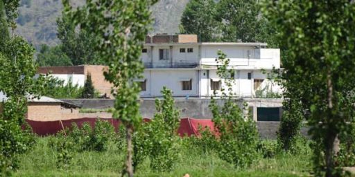
 The picture on the right is a Google Earth picture taken in 2006 of Shamsi air base in Pakistan. You can clearly see three Predator drones sitting on the tarmac. The current Google Earth picture of the same coordinates shows the same air base, sans Predators. The Times of London reports:
The US was secretly flying unmanned drones from the Shamsi airbase in Pakistan’s southwestern province of Baluchistan as early as 2006, according to an image of the base from Google Earth.
The image — that is no longer on the site but which was obtained by The News, Pakistan’s English language daily newspaper — shows what appear to be three Predator drones outside a hangar at the end of the runway. The Times also obtained a copy of the image, whose co-ordinates confirm that it is the Shamsi airfield, also known as Bandari, about 200 miles southwest of the Pakistani city of Quetta.
An investigation by The Times yesterday revealed that the CIA was secretly using Shamsi to launch the Predator drones that observe and attack al-Qaeda and Taleban militants around Pakistan’s border with Afghanistan.
US special forces used the airbase during the invasion of Afghanistan in 2001, but the Pakistani Government said in 2006 that the Americans had left. Both sides have since denied repeatedly that Washington has used, or is using, Pakistani bases to launch drones. Pakistan has also demanded that the US cease drone attacks on its tribal area, which have increased over the last year, allegedly killing several “high-value” targets as well as many civilians.
The Google Earth image now suggests that the US began launching Predators from Shamsi — built by Arab sheiks for falconry trips — at least three years ago.
It’s getting mighty hard to keep a secret these days. And the Pakistani government may have some ‘splaining to do (hat tip: Noah Schachtman for the link to Teeth Maestro).


I don’t really have much to add here, but I learn as much or more from your posts as I do any of the others here, Dave. So I am just letting James know that I am reading.
ps: what could I add? Pakistan and Afghanistan are f’d up? You done covered that.
Yeah, between Google Earth and Dianne Feinstein it’s no wonder Presidents want to do things on the down-low.
A guest at Juan Cole’s blog throws cold water on the theory:
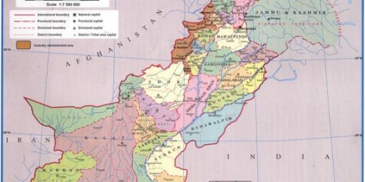
Since I am from the Northwest Frontier Province, I find it a little odd that Osama may be hiding in the only Shiite majority town in the entire tribal region of Pakistan.
The geography professors at UCLA may have used spatial analysis to determine the probable hideout of Osama; they certainly overlooked history and anthropology, which would have explained the gory sectarian rivalries between the Shiites of Parachinar and the Sunni supporters of Osama bin Laden. This is yet another example of technical analysis devoid of any understanding of the local socio-cultural and political contexts.
Of course, there’s the “they’ll never look for me here!” factor.